Underwater and marine surveying consists in the creation of maps and charts of the beds of water bodies (seas, rivers, streams, and lakes). It can be conducted by dedicated survey vessels and unmanned or autonomous vehicles such as USV systems.
It is fundamental in mining, renewable energy, engineering survey and investigation, dredging, marine and underwater construction, included structures near to water, environmental management and oil production.
Hydrographic surveys is the study which uses sonar device to collect data about water depth, topographic features and sea or river bed contour details. Hydrographic surveying is carried out by hydrographers, specialized in data acquisition and precise positioning, on/in or near water.
Hydrography, or underwater surveying, allows to determine the characteristics of an underwater area, such as the bottom elevations contour lines through the water depth, the topographical characteristics, the measurement of the tide, etc. The main measurement performed in hydrographic surveying is water depth, which can be identified in several ways, including the Echosounder tool.
In this article we will focus on the Echosounder used on a boat or on board a USV vehicle.
The Echosounder is the primary tool for depth measurement. The time interval between the emission and the return of acoustic wave represents the value for estimating the depth of the water. The echosounder system revealed the bathymetry and it is capable of recording a continuous profile of the bed. Bathymetric Surveys in deep and shallow waters map the underwater features and the depths.
Bathymetric surveys allow to measure the depth of water, as well as to map depth contours and underwater terrain; it is utilised in marine construction, Oil&Gas exploration and drilling. Bathymetric measurements use the Global Positioning System (GPS) and tools such as an Echosounder and Side Scan Sonar.
If the depth is not excessive, a pole can be lowered into the water until it touches the bottom. This pole is known as the sounding pole. When the depth is too great to use a sounding pole, a USV vehicle equipped echosounder can be utilised.

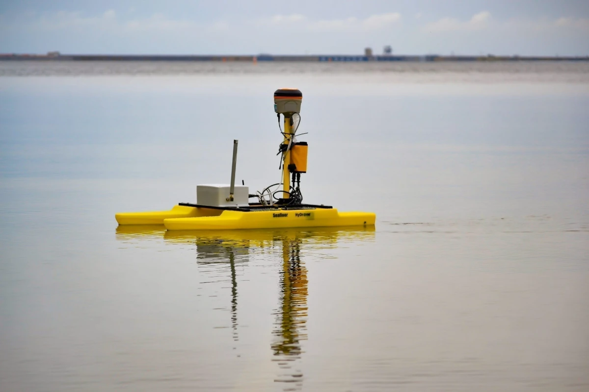
The Seafloor company has produced the HydroLite-TM ™, a portable, integrated hydrographic survey solution, robust and wireless tool that can be used for hydrographic surveying. It was developed to meet the requirements of the U.S. Army Tactical Dive Teams, it is adaptable to any vessel included USV system as on HyDrone-RCV a hand-portable, remotely controlled catamaran platform developed for bathymetric survey application. This tool quickly measures and logs depths more accurately than standard systems, making fast work of seas, ponds, rivers, lakes, and more.
Over 80% of international trade in the world takes place by sea. In order to be adequate with the constant growth in the marine and maritime sectors, it is necessary to develop modern and constantly updated nautical charts, to increase the development of maritime trade in the waters and ports. Hydrographic surveying is also an effective solution for determining the conditions of submerged areas or structures, monitoring coastal erosion and planning the construction of ports and facilities.
Read more in the Digital JP Mag – JPmag – October 2021
Jessica Moro
DSO
Paolo Mazzone
SubEng and HSE Adviser
Images
Cover: Multibeam sonar systems – Collecting Multibeam Sonar Data, by NOAA’s National Ocean Service, from flickr
Article: Seafloor HydroLite-TM mounted on HyDrone-RCV.


